Fire Hazard Severity Zones are identified by the California Department of Forestry and Fire Protection (CAL FIRE) within Local Responsibility Areas (LRA). Mapping of Very High Fire Hazard Severity Zones (VHFHSZ) is based on data and models of potential fuels over a given time horizon and their associated expected fire behavior and burn probabilities to quantify the likelihood of vegetation fire exposure to buildings.
Construction of some type of Units are prohibited within the S-9 Fire Safety Protection Combining Zone.
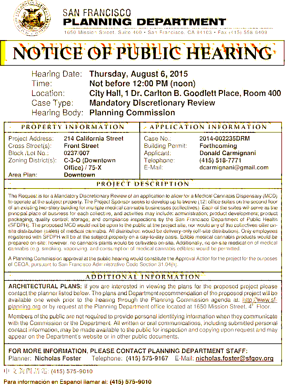
Under the California Environmental Quality Act (CEQA), certain types of work on a property may require additional environmental review. CityStructure Reports will show you if any of these restrictions apply to your property.